


Anticipez les risques physiques liés au climat et les défis réglementaires grâce à des technologies géospatiales et d'IA indépendantes
Découvrez les opportunités d'investissement et les analyses de volatilité générées par la transition énergétique, la géopolitique et la révolution de l'IA.
Grâce à la puissance des technologies géospatiales et d'IA de Kayrros, concevez et co-construisez des solutions sur mesure pour relever vos défis.
///
Prenez de meilleures décisions en matière d’énergie et d’environnement. L’IA géospatiale de Kayrros mesure de manière indépendante l’empreinte de l’activité humaine dans le monde entier.
Anticipez les risques physiques liés au climat et les défis réglementaires grâce à des technologies géospatiales et d'IA indépendantes
Découvrez les opportunités d'investissement et les analyses de volatilité générées par la transition énergétique, la géopolitique et la révolution de l'IA.
PARIS, FRANCE—21 May 2026—Market data and intelligence provider Energy Aspects has completed the acquisition of Kayrros, the Paris-based energy analytics and satellite data company. The deal is the next step in Energy Aspects’ growth plan. It strengthens the company’s data and analytics capabilities at a time when
///
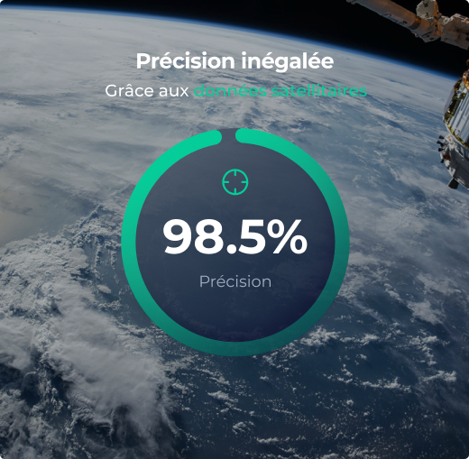
Les avancées en IA, en imagerie satellite et en observation de la Terre nous donnent désormais accès à des données en temps quasi réel sur l’impact climatique, les risques physiques, les émissions, les chaînes d’approvisionnement et les flux énergétiques. L’IA géospatiale de Kayrros permet aux entreprises, aux investisseurs et aux gouvernements d’agir plus rapidement et de prendre de meilleures décisions en période d’incertitude.
///
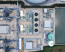
La plus grande base de données cartographiée d’actifs industriels et d’écosystèmes naturels
Technologie à l’avant-garde de la recherche scientifique, bénéficiant de la confiance des acteurs les plus exigeants
Algorithmes propriétaires assurant le traitement des images à l’échelle dans les délais les plus courts.
Technique de super-résolution permettant d'obtenir des informations exploitables au niveau de l’actif individuel, à toutes les échelles
///
La science, l'IA et l'imagerie satellitaire en temps quasi réel transforment la gouvernance climatique mondiale.
///