


Bewältigen Sie klimabedingte physische Risiken und regulatorische Herausforderungen mithilfe unabhängiger Geodaten in Kombination mit KI.
Entdecken Sie Investitionschancen und Erkenntnisse zur Volatilität im Kontext der Energiewende, Geopolitik und der KI-Revolution.
Dank der leistungsstarken Geodaten- und KI-Technologien von Kayrros können Sie maßgeschneiderte Lösungen entwerfen und gemeinsam entwickeln, um Ihre Herausforderungen zu bewältigen.
///
Genauigkeit
Kayrros-Wissenschaftler haben zahlreiche Artikel in hochrangigen, von Experten begutachteten Fachzeitschriften verfasst. Dazu gehören:
Globale Bewertung der Methan-Ultra-Emittenten aus Öl und Gas. Wissenschaft.
Globale Muster der täglichen CO²-Emissionsreduzierung im ersten Jahr von COVID-19. Nature Geoscience.
Vergleich der in den UNFCCC-Inventaren angegebenen nationalen Treibhausgasbudgets mit atmosphärischen Inversionen.
Digitales Twinning aller Wald- und Nicht-Waldbäume auf nationaler Ebene durch Deep Learning.
Proceedings of the National Academy of Sciences.
Globale Verfolgung und Quantifizierung von Methanaustritten aus Öl- und Gasvorkommen anhand von wiederkehrenden Sentinel-2-Bildern.
Umweltwissenschaft und -technologie
EU-Kohlenstoffemissionen aus regulierten Sektoren: Tägliche Kayrros-Messungen vs. verzögerte offizielle jährliche Schätzungen
Kumulative Kayrros-Patentanmeldungen
Eine Liste der Veröffentlichungen, die unsere Ergebnisse zitieren, finden Sie
Kayrros arbeitet mit führenden Forschungseinrichtungen auf der ganzen Welt zusammen und hat zahlreiche technologische Patente angemeldet.
Die echtzeitnahen Daten von Kayrros haben sich stets als äußerst genaue Vorläufer der offiziellen Datenveröffentlichungen erwiesen, wann immer sie verfügbar sind.
So haben beispielsweise die täglichen, nahezu in Echtzeit durchgeführten Messungen der europäischen Kohlenstoffemissionen von Kayrros in zwei aufeinander folgenden Jahren mit einer Genauigkeit von mehr als 98,5 % mit den verzögerten Jahresdaten der EU übereingestimmt.
Abdeckung
Kayrros ist ein One-Stop-Shop für alle wichtigen Klimamessungen
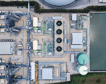
Kayrros hat alle materiellen Güter, die auf globaler Ebene am wichtigsten sind, kartiert und misst alle Parameter, die für die Energiewende relevant sind, um die beste und umfassendste Erfassung von Energie und Umwelt zu gewährleisten.
In processing and analyzing satellite imagery, Kayrros leverages a fast-growing proprietary database of more than 5 million physical assets, to cover all dimensions of the energy transition.
Kayrros measurements include new production capacity, production volumes, flows, inventories, intermediate and final consumption and associated greenhouse gas emissions and pollutants for all forms of energy and associated materials. Kayrros also tracks energy infrastructure growth and models and measures physical risks and damages associated with climate change, including wildfires, shrink–swell subsidence, landslides, and extreme temperature events such as heatwaves, cold spells, and heavy rainfall.
.
Tägliche Messungen von Dutzenden von Parametern und Millionen von Vermögenswerten schaffen die bestmögliche unabhängige Berichterstattung über Energie und Umwelt.
Mehrwert
///
///
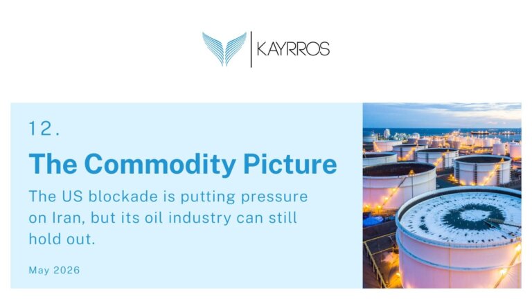
The US blockade is putting pressure on Iran, but its oil industry can still hold out
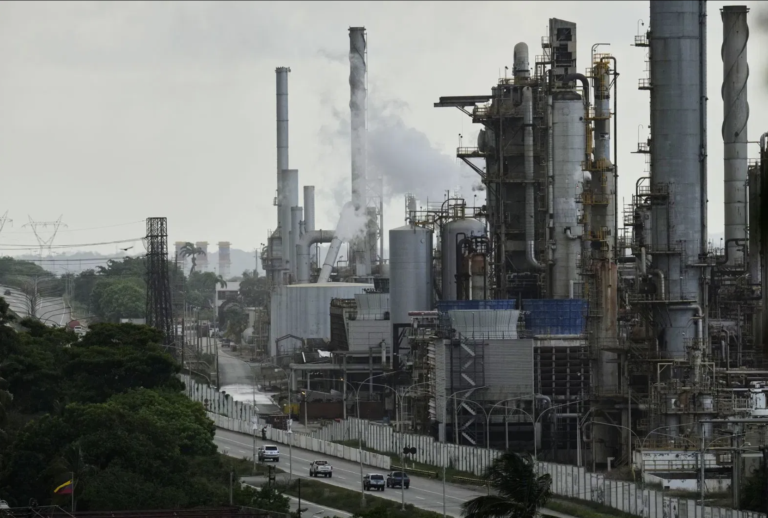
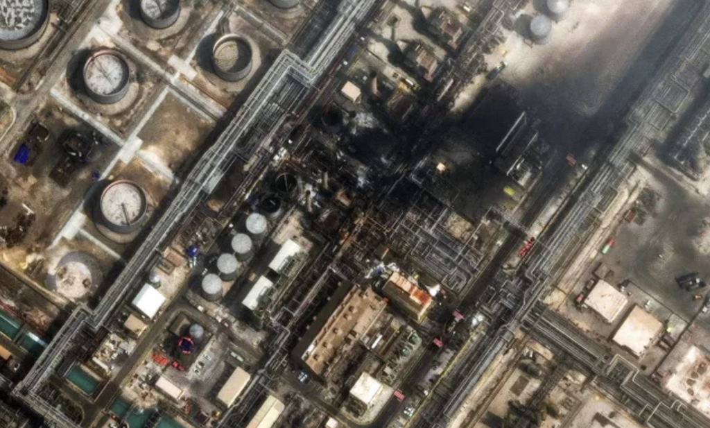
Data Reveals Significant Damage to Kuwaiti Refineries and KPC
Will the Closure of the Strait of Hormuz Force Arab Gulf Crude Oil Exporters to Shut-in Production?
List of papers citing our results
[1] T. Dagobert, R. Grompone von Gioi, C. de Franchis, and C. Hessel, “Detection and Interpretation of Change in Registered Satellite Image Time Series,” Image Process. Line, vol. 12, pp. 625–651, Dec. 2022, doi: 10.5201/ipol.2022.416.
[2] R. Akiki, C. de Franchis, G. Facciolo, J.-M. Morel, and R. Grandin, “Phase Unwrapping using a Joint CNN and SQD-LSTM Network,” Image Process. Line, vol. 12, pp. 378–388, Oct. 2022, doi: 10.5201/ipol.2022.425.
[3] T. Lauvaux et al., “Global assessment of oil and gas methane ultra-emitters,” Science (80-. )., vol. 375, no. 6580, pp. 557–561, Feb. 2022, doi: 10.1126/science.abj4351.
[4] Z. Deng et al., “Comparing national greenhouse gas budgets reported in UNFCCC inventories against atmospheric inversions,” Earth Syst. Sci. Data, vol. 14, no. 4, pp. 1639–1675, Apr. 2022, doi: 10.5194/essd-14-1639-2022.
[5] Z. Liu et al., “Global patterns of daily CO2 emissions reductions in the first year of COVID-19,” Nat. Geosci., vol. 15, no. 8, pp. 615–620, Aug. 2022, doi: 10.1038/s41561-022-00965-8.
[6] N. L. Nguyen, J. Anger, A. Davy, P. Arias, and G. Facciolo, “Self-Supervised Super-Resolution for Multi-Exposure Push-Frame Satellites,” in 2022 IEEE/CVF Conference on Computer Vision and Pattern Recognition (CVPR), Jun. 2022, pp. 1848–1858, doi: 10.1109/CVPR52688.2022.00190.
[7] T. Ehret et al., “Global Tracking and Quantification of Oil and Gas Methane Emissions from Recurrent Sentinel-2 Imagery,” Environ. Sci. Technol., vol. 56, no. 14, pp. 10517–10529, Jul. 2022, doi: 10.1021/acs.est.1c08575.
[8] R. Grompone von Gioi, C. Hessel, T. Dagobert, J.-M. Morel, and C. de Franchis, “Cloud detection by inter-band parallax and a-contrario validation,” in ISPRS Annals of Photogrammetry, Remote Sensing and Spatial Information Sciences, 2022, vol. 5, no. 3, pp. 39–46, doi: 10.5194/isprs-Annals-V-3-2022-39-2022.
[9] R. Marí, T. Ehret, J. Anger, C. de Franchis, and G. Facciolo, “L1B+: a Perfect Sensor Localization Model for Simple Satellite Stereo Reconstruction From Push-Frame Image Strips,” in ISPRS Annals of the Photogrammetry, Remote Sensing and Spatial Information Sciences, 2022, vol. 5, no. 1, pp. 137–143, doi: 10.5194/isprs-annals-V-1-2022-137-2022.
[10] E. Ouerghi et al., “Automatic methane plumes detection in time series of Sentinel-5P L1B images,” in ISPRS Annals of the Photogrammetry, Remote Sensing and Spatial Information Sciences, 2022, vol. 5, no. 3, pp. 147–154, doi: 10.5194/isprs-Annals-V-3-2022-147-2022.
[11] N. L. Nguyen, J. Anger, A. Davy, P. Arias, and G. Facciolo, “Self-Supervised Push-Frame Super-Resolution With Detail-Preserving Control And Outlier Detection,” in International Geoscience and Remote Sensing Symposium (IGARSS), 2022, pp. 131–134, doi: 10.1109/IGARSS46834.2022.9883593.
[12] T. Ehret, A. De Truchis, M. Mazzolini, J.-M. Morel, and G. Facciolo, “Automatic Methane Plume Quantification Using Sentinel-2 Time Series,” in International Geoscience and Remote Sensing Symposium (IGARSS), 2022, pp. 1955–1958, doi: 10.1109/IGARSS46834.2022.9884134.
[13] F. Marchesoni-Acland, M. D’Autume, G. Facciolo, C. de Franchis, J.-M. Morel, and E. Meinhardt-Llopis, “Interactive Segmentation for Shape From Shading over HR SAR images,” in International Geoscience and Remote Sensing Symposium (IGARSS), 2022, pp. 975–978, doi: 10.1109/IGARSS46834.2022.9884193.
[14] R. Akiki, J. Anger, C. de Franchis, G. Facciolo, J.-M. Morel, and R. Grandin, “Improved Sentinel-1 IW Burst Stitching Through Geolocation Error Correction Considerations,” in International Geoscience and Remote Sensing Symposium (IGARSS), 2022, pp. 3404–3407, doi: 10.1109/IGARSS46834.2022.9883116.
[15] T. Ehret, S. Lajouanie, V. Lefrançois, and C. de Franchis, “Automatic Monitoring of Water Level in Small Lakes Using Planetscope,” in International Geoscience and Remote Sensing Symposium (IGARSS), 2021, pp. 3356–3359, doi: 10.1109/IGARSS47720.2021.9554431.
[16] R. Marí, C. de Franchis, E. Meinhardt-Llopis, and G. Facciolo, “Automatic Stockpile Volume Monitoring Using Multi-View Stereo From SkySat Imagery,” in International Geoscience and Remote Sensing Symposium (IGARSS), 2021, pp. 4384–4387, doi: 10.1109/IGARSS47720.2021.9554482.
[17] R. Marí, C. de Franchis, E. Meinhardt-Llopis, J. Anger, and G. Facciolo, “A Generic Bundle Adjustment Methodology for Indirect RPC Model Refinement of Satellite Imagery,” Image Process. Line, vol. 11, pp. 344–373, Nov. 2021, doi: 10.5201/ipol.2021.352.
[18] N. L. Nguyen, J. Anger, A. Davy, P. Arias, and G. Facciolo, “Self-supervised multi-image super-resolution for push-frame satellite images,” in 2021 IEEE/CVF Conference on Computer Vision and Pattern Recognition Workshops (CVPRW), Jun. 2021, pp. 1121–1131, doi: 10.1109/CVPRW53098.2021.00123.
[19] R. Grompone von Gioi, C. Hessel, T. Dagobert, J.-M. Morel, and C. de Franchis, “Ground Visibility in Satellite Optical Time Series Based on A Contrario Local Image Matching,” Image Process. Line, vol. 11, pp. 212–233, Jul. 2021, doi: 10.5201/ipol.2021.342.
[20] R. Akiki, R. Mari, C. de Franchis, J.-M. Morel, and G. Facciolo, “Robust Rational Polynomial Camera Modelling for SAR and Pushbroom Imaging,” in International Geoscience and Remote Sensing Symposium (IGARSS), 2021, pp. 7908–7911, doi: 10.1109/igarss47720.2021.9554583.
[21] R. Akiki, R. Grandin, C. de Franchis, G. Facciolo, and J.-M. Morel, “A Comparative Study of Deramping Techniques for Sentinel-1 TOPS in the Context of Interferometry,” in International Geoscience and Remote Sensing Symposium (IGARSS), Jul. 2021, pp. 3372–3375, doi: 10.1109/IGARSS47720.2021.9553049.
[22] N. L. Nguyen, J. Anger, A. Davy, P. Arias, and G. Facciolo, “Proba-V-Ref: Repurposing the Proba-V Challenge for Reference-Aware Super Resolution,” in International Geoscience and Remote Sensing Symposium (IGARSS), 2021, pp. 3881–3884, doi: 10.1109/IGARSS47720.2021.9554479.
[23] J. Anger, T. Ehret, and G. Facciolo, “Parallax Estimation for Push-Frame Satellite Imagery: Application To Super-Resolution and 3D Surface Modeling From SkySat Products,” in International Geoscience and Remote Sensing Symposium (IGARSS), 2021, pp. 2679–2682, doi: 10.1109/IGARSS47720.2021.9554340.
[24] E. Ouerghi et al., “Detection of Methane Emissions Using Pattern Recognition,” in International Geoscience and Remote Sensing Symposium (IGARSS), 2021, pp. 3773–3776, doi: 10.1109/IGARSS47720.2021.9553897.
[25] C. Hessel, C. de Franchis, G. Facciolo, and J.-M. Morel, “A Global Registration Method for Satellite Image Series,” in International Geoscience and Remote Sensing Symposium (IGARSS), Jul. 2021, pp. 3121–3124, doi: 10.1109/IGARSS47720.2021.9554786.
[26] C. Williams, T. Dagobert, C. de Franchis, J.-M. Morel, and C. Hessel, “Fast Accurate Supervised Cloud Annotation,” in International Geoscience and Remote Sensing Symposium (IGARSS), Jul. 2021, pp. 3237–3240, doi: 10.1109/IGARSS47720.2021.9554213.
[27] M. Rodriguez et al., “A CNN Cloud Detector for Panchromatic Satellite Images,” in International Geoscience and Remote Sensing Symposium (IGARSS), Jul. 2021, pp. 4964–4967, doi: 10.1109/IGARSS47720.2021.9554059.
[28] T. Dagobert, R. Grompone von Gioi, C. Hessel, J.-M. Morel, and C. de Franchis, “Change Analysis in Registered Satellite Image Time Series,” in International Geoscience and Remote Sensing Symposium (IGARSS), Jul. 2021, pp. 4360–4363, doi: 10.1109/IGARSS47720.2021.9554700.
[29] E. Ouerghi et al., “Detection of methane plumes in hyperspectral images from Sentinel-5P by coupling anomaly detection and pattern recognition,” in ISPRS Annals of the Photogrammetry, Remote Sensing and Spatial Information Sciences, 2021, vol. 5, no. 3, pp. 81–87, doi: 10.5194/isprs-annals-V-3-2021-81-2021.
[30] M. Colom, T. Dagobert, C. de Franchis, R. Grompone von Gioi, C. Hessel, and J.-M. Morel, “Using the IPOL Journal for Online Reproducible Research in Remote Sensing,” IEEE J. Sel. Top. Appl. Earth Obs. Remote Sens., vol. 13, pp. 6384–6390, 2020, doi: 10.1109/JSTARS.2020.3032100.
[31] T. Dagobert, R. Grompone von Gioi, C. de Franchis, J.-M. Morel, and C. Hessel, “Cloud Detection by Luminance and Inter-band Parallax Analysis for Pushbroom Satellite Imagers,” Image Process. Line, vol. 10, pp. 167–190, Nov. 2020, doi: 10.5201/ipol.2020.271.
[32] T. Dagobert, R. Grompone von Gioi, J.-M. Morel, and C. de Franchis, “Temporal Repetition Detector for Time Series of Spectrally Limited Satellite Imagers,” Image Process. Line, vol. 10, pp. 62–77, Jun. 2020, doi: 10.5201/ipol.2020.245.
[33] A. Tadros, S. Drouyer, R. Grompone von Gioi, and L. Carvalho, “Oil Tank Detection in Satellite Images via a Contrario Clustering,” in International Geoscience and Remote Sensing Symposium (IGARSS), 2020, pp. 2233–2236, doi: 10.1109/IGARSS39084.2020.9323249.
[34] A. Tadros, S. Drouyer, R. Grompone von Gioi, G. Facciolo, and L. Carvalho, “Circular-Shaped Object Detection in Low Resolution Satellite Images,” in ISPRS Annals of the Photogrammetry, Remote Sensing and Spatial Information Sciences, 2020, vol. 5, no. 2, pp. 901–908, doi: 10.5194/isprs-annals-V-2-2020-901-2020.
[35] M. D’Autume, A. Perry, J.-M. Morel, E. Meinhardt-Llopis, and G. Facciolo, “Stockpile Monitoring Using Linear Shape-From-Shading on Planetscope Imagery,” in ISPRS Annals of the Photogrammetry, Remote Sensing and Spatial Information Sciences, 2020, vol. 5, no. 2, pp. 427–434, doi: 10.5194/isprs-annals-V-2-2020-427-2020.
[36] J. Anger, T. Ehret, C. de Franchis, and G. Facciolo, “Fast and Accurate Multi-Frame Super-Resolution of Satellite Images,” in ISPRS Annals of the Photogrammetry, Remote Sensing and Spatial Information Sciences, 2020, vol. 5, no. 1, pp. 57–64, doi: 10.5194/isprs-annals-V-1-2020-57-2020.
[37] R. Grompone von Gioi, C. Hessel, T. Dagobert, J.-M. Morel, and C. de Franchis, “Temporal Repetition Detection for Ground Visibility Assessment,” in ISPRS Annals of the Photogrammetry, Remote Sensing and Spatial Information Sciences, 2020, vol. 5, no. 2, pp. 829–835, doi: 10.5194/isprs-annals-V-2-2020-829-2020.
[38] S. Drouyer and C. de Franchis, “Parking Occupancy Estimation on Sentinel-1 Images,” in ISPRS Annals of the Photogrammetry, Remote Sensing and Spatial Information Sciences, 2020, vol. 5, no. 2, pp. 821–828, doi: 10.5194/isprs-annals-V-2-2020-821-2020.
[39] C. Hessel, R. Grompone von Gioi, J.-M. Morel, G. Facciolo, P. Arias, and C. de Franchis, “Relative Radiometric Normalization Using Several Automatically Chosen Reference Images for Multi-Sensor, Multi-Temporal Series,” in ISPRS Annals of the Photogrammetry, Remote Sensing and Spatial Information Sciences, 2020, vol. 5, no. 2, pp. 845–852, doi: 10.5194/isprs-annals-V-2-2020-845-2020.
[40] S. Drouyer and C. de Franchis, “Highway Traffic Monitoring on Medium Resolution Satellite Images,” in International Geoscience and Remote Sensing Symposium (IGARSS), Jul. 2019, pp. 1228–1231, doi: 10.1109/IGARSS.2019.8899777.
[41] P. Chiberre, E. Meinhardt-Llopis, C. de Franchis, and G. Facciolo, “3D Modeling of Earth’s Surface: Study of the Antarctica,” in International Geoscience and Remote Sensing Symposium (IGARSS), Jul. 2019, pp. 1088–1091, doi: 10.1109/IGARSS.2019.8900179.
[42] T. Dagobert, J.-M. Morel, C. de Franchis, and R. Grompone von Gioi, “Visibility Detection in Time Series of Planetscope Images,” in International Geoscience and Remote Sensing Symposium (IGARSS), Jul. 2019, pp. 1673–1676, doi: 10.1109/IGARSS.2019.8898892.
[43] J. Anger, C. de Franchis, and G. Facciolo, “Assessing the Sharpness of Satellite Images: Study of the Planetscope Constellation,” in International Geoscience and Remote Sensing Symposium (IGARSS), Jul. 2019, pp. 389–392, doi: 10.1109/IGARSS.2019.8900526.
[44] R. Mari, C. de Franchis, E. Meinhardt-Llopis, and G. Facciolo, “To bundle adjust or not: A comparison of relative geolocation correction strategies for satellite multi-view stereo,” in International Conference on Computer Vision Workshop, ICCVW, 2019, pp. 2188–2196, doi: 10.1109/ICCVW.2019.00274.